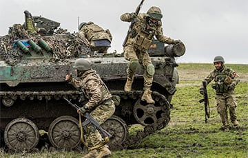
Ukrainian Advances In Donetsk Around Svatove, Kreminna Sustained, Bakhmut holds
Increasing numbers of reports indicate Ukrainian forces are advancing along the key Highway P66 axis in Donetsk, suggesting they have identified Russian troop weakness in that area.
If reconfirmed, this advance leads the Ukrainians directly east. JL
Mark Sumner reports in Daily Kos:
Earlier today, a group of Russian’s surrendering
in the area west of Svatove near Kolomyichykha, one of the few locations
that Russia still holds on the west side of the highway. Mediation was
reportedly carried out using a consumer-grade quadcopter drone, which
then led the Russians to a location to lay down the arms and wait for
Ukrainian troops. there are even more reports of Ukrainian movement toward both Svatove and Kreminna. Ukraine is in control of Chervonopopivka along the P66 highway north of
Kreminna. While there has been no official announcement of the
liberation of this location, the Ukrainian military on Friday reported
that they had repelled a Russian assault on Chervonopopivka, indicating
that this area is under the control of Ukrainian forces.
Earlier today, there were reports of a group of Russian’s surrendering in the area west of Svatove near Kolomyichykha, one of the few locations that Russia still holds on the west side of the highway. Mediation was reportedly carried out using a consumer-grade quadcopter drone, which then led the Russians to a location to lay down the arms and wait for Ukrainian troops.
[Sorry, this was deleted earlier because I jumped the gun and added an update while the valiant warriors of proofing were still in there doing battle with my many, many mistakes.]
On Friday, there are even more reports of Ukrainian movement toward both Svatove and Kreminna. Meanwhile, some of those reported Russian gains south of Bakhmut—shockingly enough—might not be as large or decisive as Russia and pro-Russian sources have been claiming.
On Thursday, there were images of a Russian position being overrun. After first indicating it was near Svatove, sources then indicated that the base had been geolocated closer to Kreminna, though they didn’t specify where. According to Ukrainian military sources, Ukraine actually took that position shown in the video some days ago and pushed on, which is why the Ukrainian military felt safe about allowing that video to appear.
Overnight, the reported location of that base featured in multiple videos and images changed again, the latest reports placing it northwest of Svatove at Kuzemivka.
Ukraine appears to have advanced toward Svatove at multiple locations. Open in another tab for a larger view.
Fighting has been going on at Kuzemivka for more than two weeks. Video released in the last two days confirms Ukrainian control of neighboring Novoselivske and showed Ukrainian troops there moving through that town without any apparent threat. That makes much more sense if Ukraine has now actually taken Kuzemivka. Russia had made this a hard point in their defense of Svatove, and if Ukraine now holds this location, it's a major step toward liberating the whole area. I’m waiting for more confirmation (and to make sure the reported location of this base doesn’t move again) before updating the map. But this sounds like a good thing.
Another video is making the rounds on Friday, and this one not only shows another location where multiple Russian units were destroyed, but it also carries a definite location.
That location is actually some 30km northwest of Svatove between the towns of Kyslivka and Nova Tarsivka. It matches perfectly with images showing Russian equipment being destroyed last Saturday, so though I’ve marked it with an attack symbol on this map, it actually represents a point to which we know Ukraine has advanced.
It’s probable that this video, like that of the base at Kuzemivka(?), is several days old. Ukraine may have moved on from this location. However, there has been no official announcement (or even an unofficial claim) concerning Nova Tarsivka. Should Ukraine take that position, it would help remove Russian forces from the area and protect the flank of Ukrainian troops moving down the highway from Kupyansk toward Svatove—a route that has been, and still is, coming under assault or artillery attack at several locations. But taking Nova Tarsivka wouldn’t actually represent much in terms of another route into Svatove, as Nova Tarsivka is pretty much an end-of-the-road location. There is a road going on to Verkhnya Duvanka, but it is dirt, appears to have been in bad shape even before the rainy season began, and would undoubtedly be hard slogging at this time.
Finally, there are reports of fighting along the P66 highway south of the P66/P07 intersection just west of Svatove. This could be Ukrainian forces that have pushed forward form Popivka, but some sources have indicated that Ukrainian troops were moving out of Raihorodka. It’s hard to be sure of anything, including the exact location of the fighting. To secure a connection to the highway that’s not under continuous assault, Ukraine will need to take that whole little wedge in there from Patalakhivka to Popivka. That may be what’s underway.
Ukraine has had a hard time with all the routes moving to Svatove. Russian forces have been able to maintain artillery to the east of the highway, keeping Ukrainian units under fire control as they’ve tried to approach from the northwest. Russian forces have also reportedly staged multiple ambushes from wooded areas along the roads. In addition to being slowed by mud, it seems that Ukraine has been forced to slow down and do a lot of clean-up operations.
Speaking of clearing out areas along the highway, that point up there at Volorymrivka has been one position from which Russia has been able to fire on forces moving along the highway. Clearing it has been made extra difficult because the road into Volorymrivka doesn’t originate over near Krokhmalne; it comes up from Kuzemivka. If Ukraine does not control Kuzemivka, don’t be surprised to hear that Russian forces in Volorymrivka have been eliminated.
Meanwhile, 40km to the south …
Ukraine appears to be taking areas along highway north of Kreminna. Open in another tab for a larger view.
The biggest change on the map here is that I’m showing Ukraine in control of Chervonopopivka along the P66 highway north of Kreminna. While there has been no official announcement of the liberation of this location, the Ukrainian military on Friday reported that they had repelled a Russian assault on Chervonopopivka, indicating that this area is under the control of Ukrainian forces. Likewise, the military again confirmed Ukrainian control at Ploshchanka with reports of Russian shelling of the area.
There is reportedly still fighting in the area of Holykove, which leaves open the question of how in the heck Ukrainian troops made it to Chervonopopivka in sufficient forces to hold the town against a Russian assault. The road going directly to the west is long and twisty, and features enough up-and-down to make muddy conditions even more difficult. But in any case, it seems that Ukraine is there, and they are very close to holding not just fire control, but also physical control of a whole length of the highway along with the associated towns.
At the same time, Ukraine is reportedly fighting its way through the wooded area south of Kreminna. Reports of action on Friday morning indicated that Ukrainian forces were just 2km outside of the city. There were also indications that the particular Dibrova west of Kreminna (to distinguish it from other Dibrovas, including one only a few kilometers away) is again under Ukrainian control.
The movement toward Svatove and Kreminna hasn’t been the kind of swift action that saw so much of Kharkiv liberated within a few days, but it’s not been too dissimilar from the fighting that saw Lyman and the surrounding area liberated. Manuever and reinforce. Capture a village, secure a route, keep the options open.
Ukraine’s position has been difficult, not just because Russia has significant forces in the area, and not just because they were facing mud, but because they’ve been making a west-to-east move in an area where all the major highways tend to run north to south. If Ukraine can secure the P66—and push Russia back far enough that the road is not easily blanketed by short-range artillery—it will be a major step, not just in liberating Kreminna and Svatove, but in pushing Russia out of the entire region.
And now, another 50km south …
A repeat of Thursday’s map at Bakhmut. Open in another tab for a larger view.
I’ve repeated Thursday’s map here because the thing that’s really changed at Bakhmut is the certainty. On Wedneday, Russian sources indicated that they had completely captured the towns of Ozarianivka and Kurdyumivka, a claim that was supported by images of Russian soldiers gathered around the signs for those locations. However, on Friday, Ukrainian sources claim that Russia does not hold all of either location and that Ukrainian troops in fortified positions are still in place.
So that big red arrow, which was tied to Russian reports that they were moving on to villages a few kilometers west, appears to be premature.
Ukraine also reported that Russia attempted to advance at Optyne and in the direction of Klishchiivka. Both assaults were repulsed. In what now appears to be an endless situation … Bakhmut holds.
As a Partner and Co-Founder of Predictiv and PredictivAsia, Jon specializes in management performance and organizational effectiveness for both domestic and international clients. He is an editor and author whose works include Invisible Advantage: How Intangilbles are Driving Business Performance. Learn more...


0 comments:
Post a Comment